MS-GIST at University of Arizona
Geodatabases
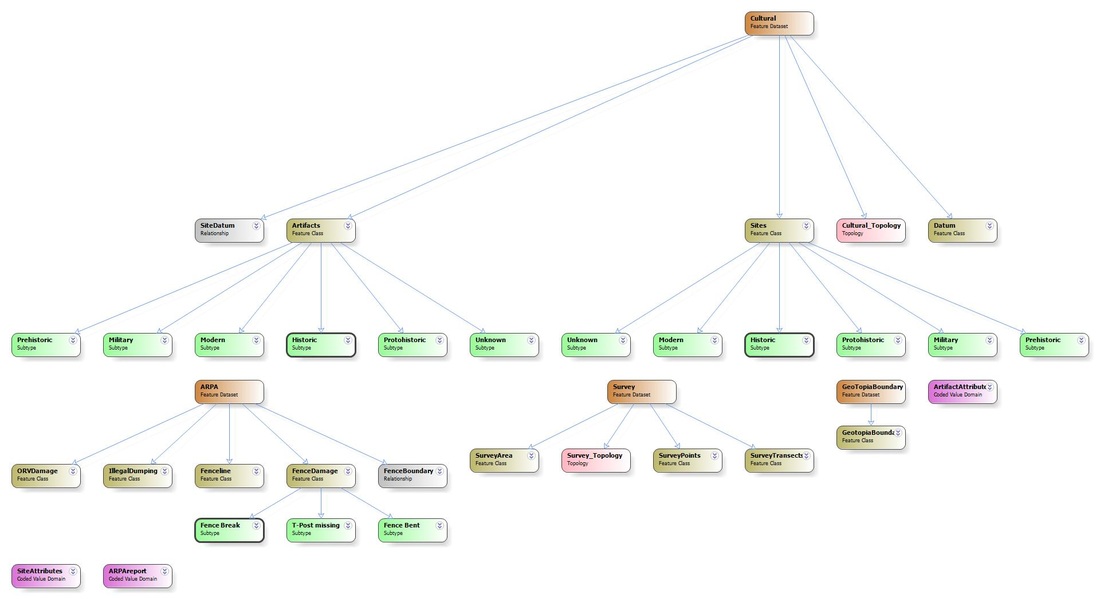
For this project, we were tasked with creating a geodatabase complete with feature datasets, feature classes, subtypes, domains, realtionships and topology.
I decided to continue with the archaeology theme, and built on the scaffolding of a similar project completed at AVC in 2012.
This time we used MindMaple and ArcGIS Diagrammer to organize our data.
We then were able to export our diagrams to ArcMap as an .xml file.
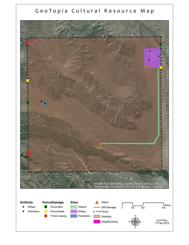
We were also given the option to digitize the data we had created, and make a map.
Below are my Diagrammer results and my final map, with digitized data.
I decided to continue with the archaeology theme, and built on the scaffolding of a similar project completed at AVC in 2012.
This time we used MindMaple and ArcGIS Diagrammer to organize our data.
We then were able to export our diagrams to ArcMap as an .xml file.
We were also given the option to digitize the data we had created, and make a map.
Below are my Diagrammer results and my final map, with digitized data.