MS-GIST at University of Arizona
Spatial Analysis 1
A selection of maps and screenshots from various labs in the first Spatial Analysis section of the program.
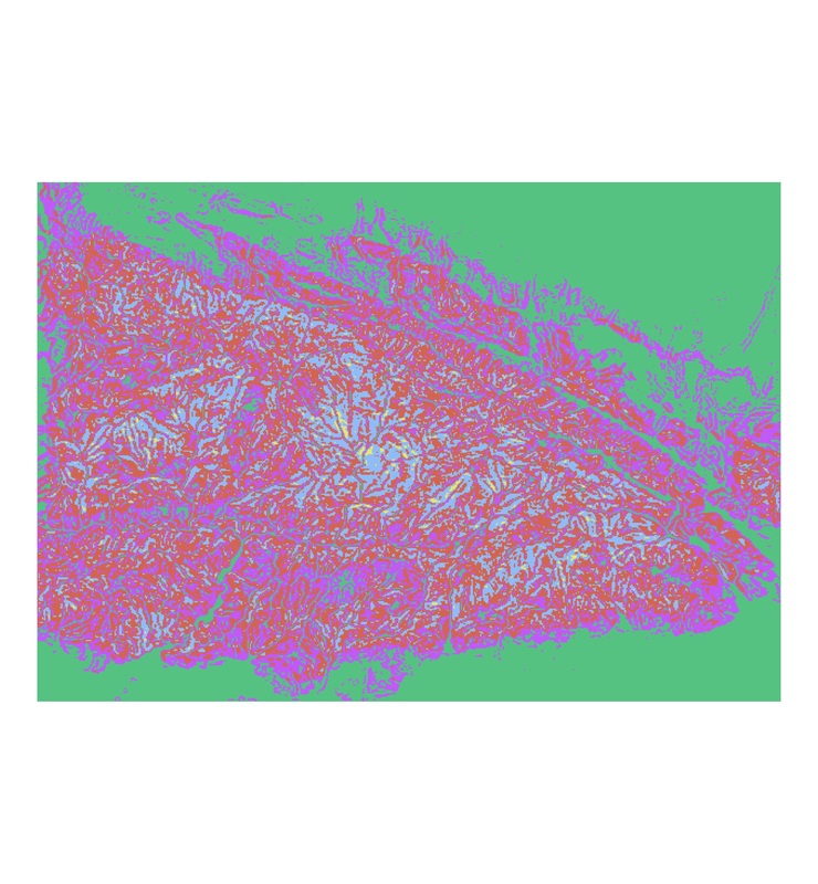
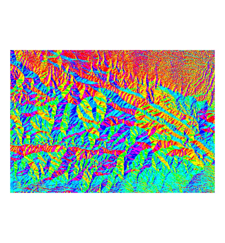
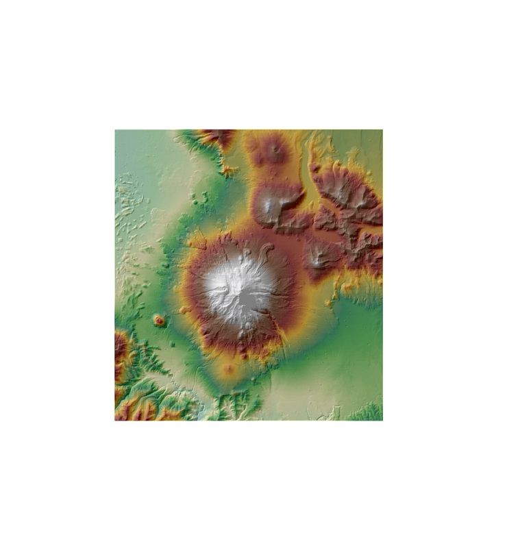
Terrain Analysis
Reclassed slope.
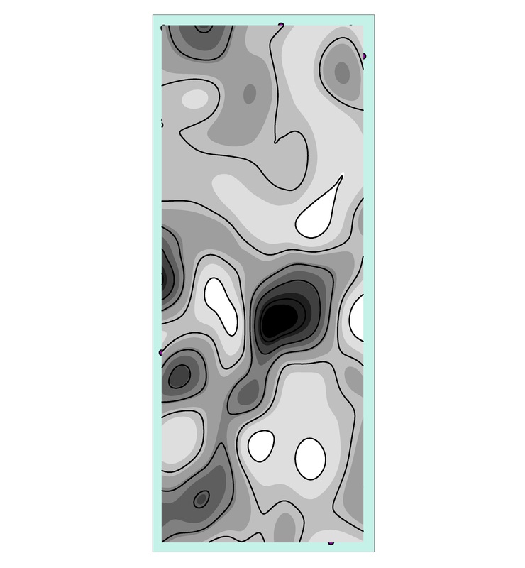
Potassium surface generated from soil sample points.
|
Reclassed aspect
Smoothed surface created by subtracting an unfiltered layer from from a low pass filter using raster calculator.
|
Map Algebra
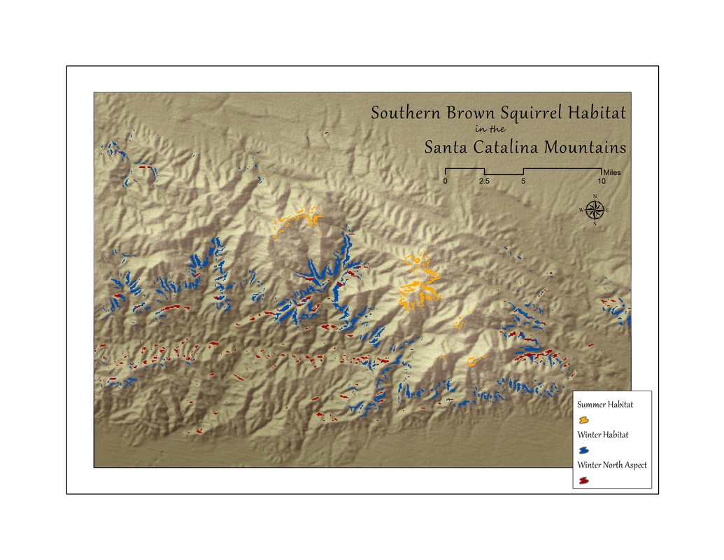
Final map showing ideal squirrel habitat locations based on season and aspect.
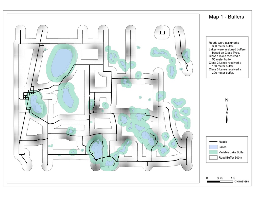
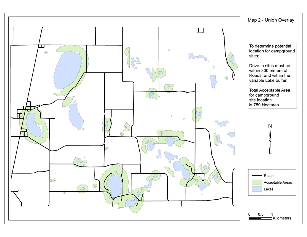
Vector Buffering & Overlay
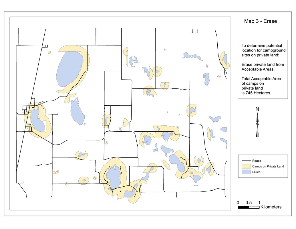
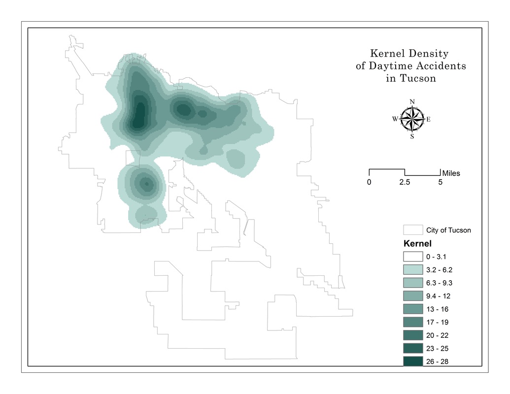
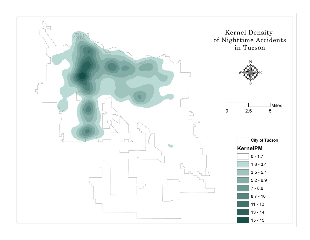
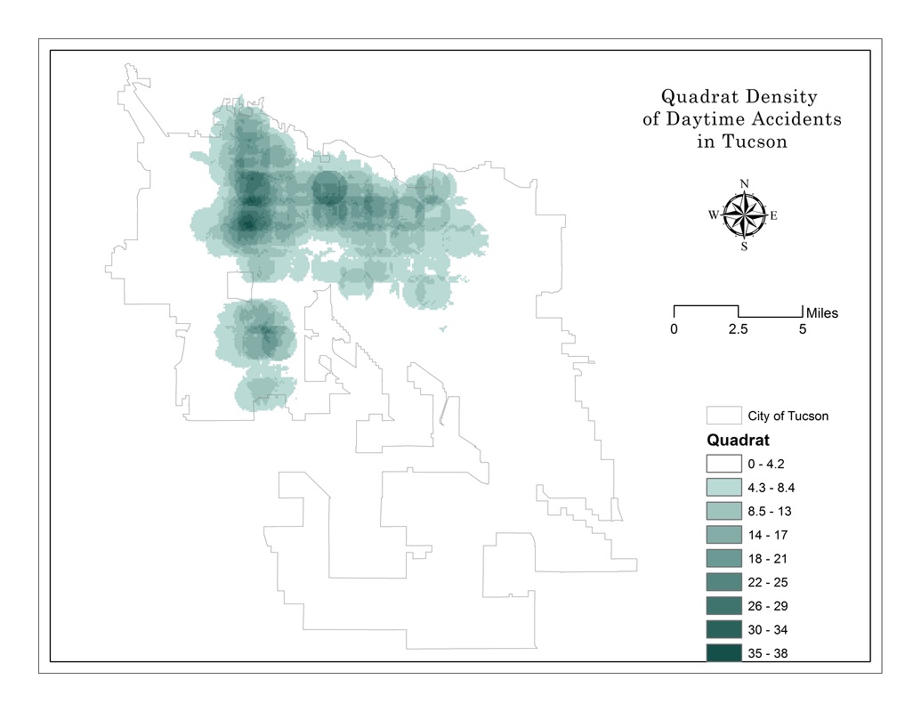
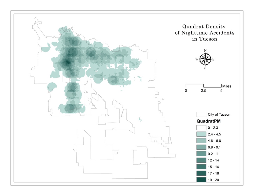
Point Pattern Analysis
Analysis of car accident rates using nearest neighbor, Ripley's K, Quadrat count and Kernel Density.
|
|
|
|
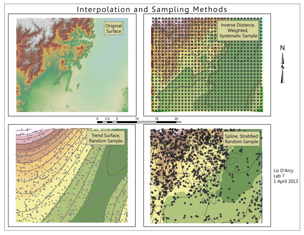
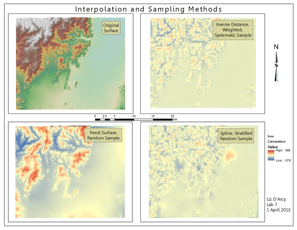
Spatial Interpolation
Various spatial interpolation methods: IDW, trend surface, spline, then error surfaces for each method.
|
|
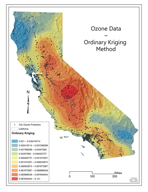
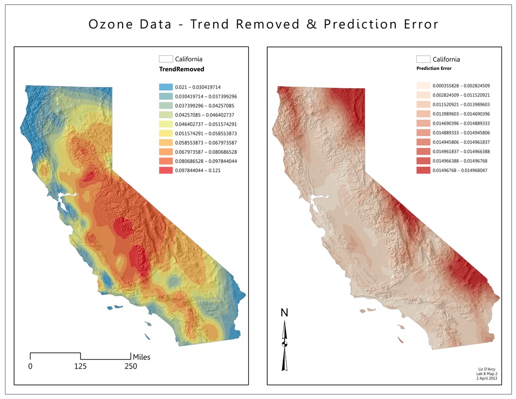
Kriging
Prediction of ozone levels throughout California derived from monitoring stations at specific locations.
|
|
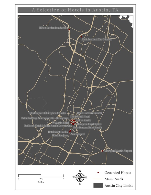
Geocoding
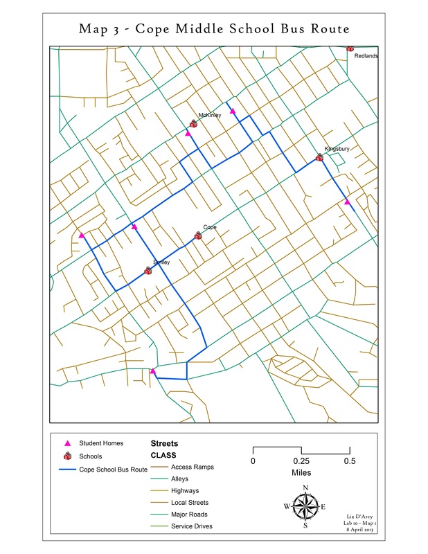
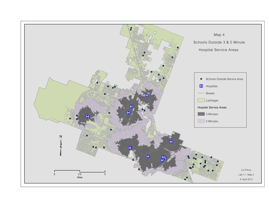
Network Analysis
Building a network and solving traffic routing problems.
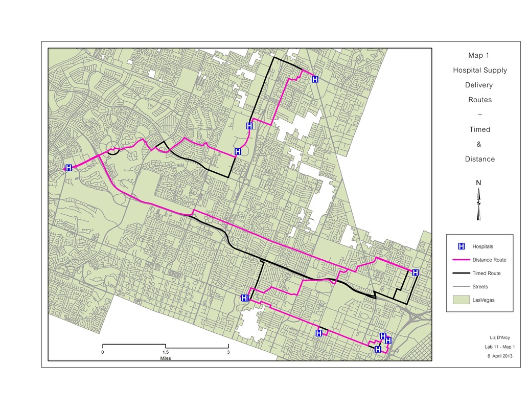
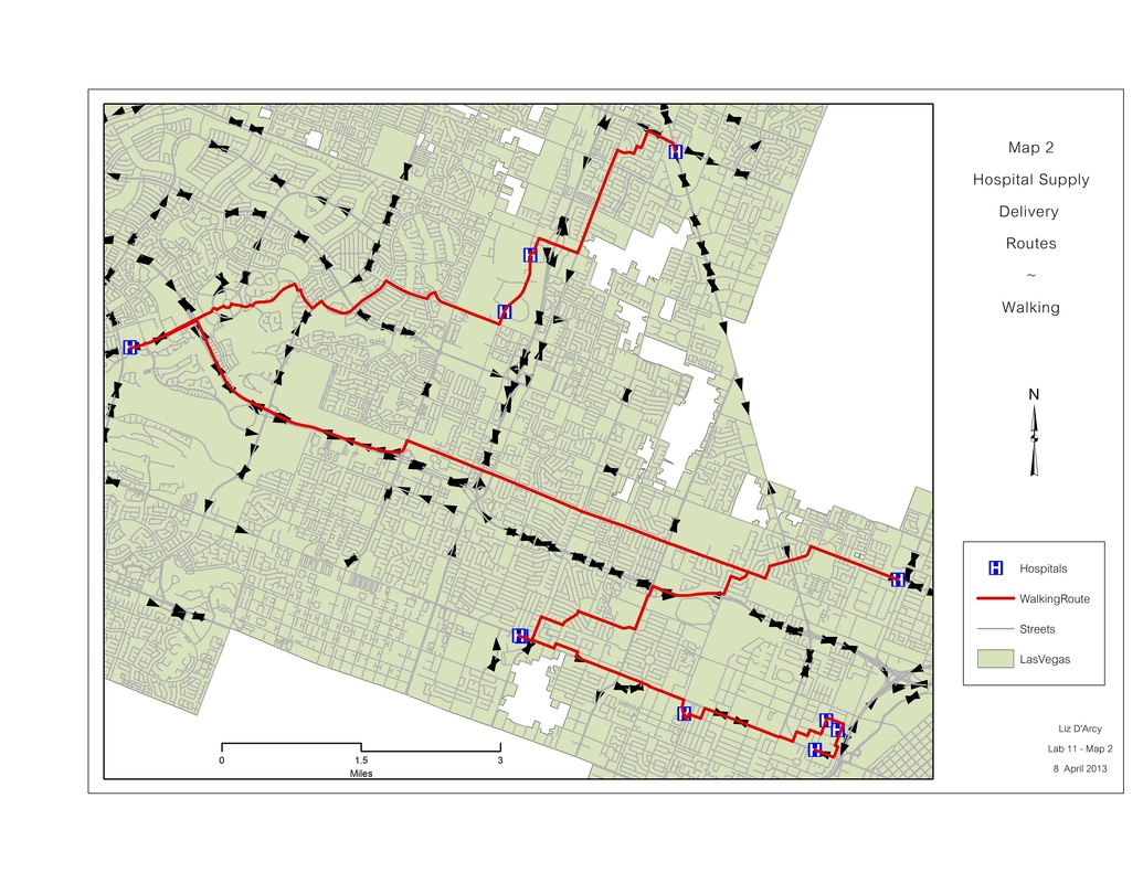
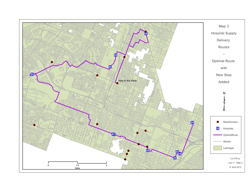
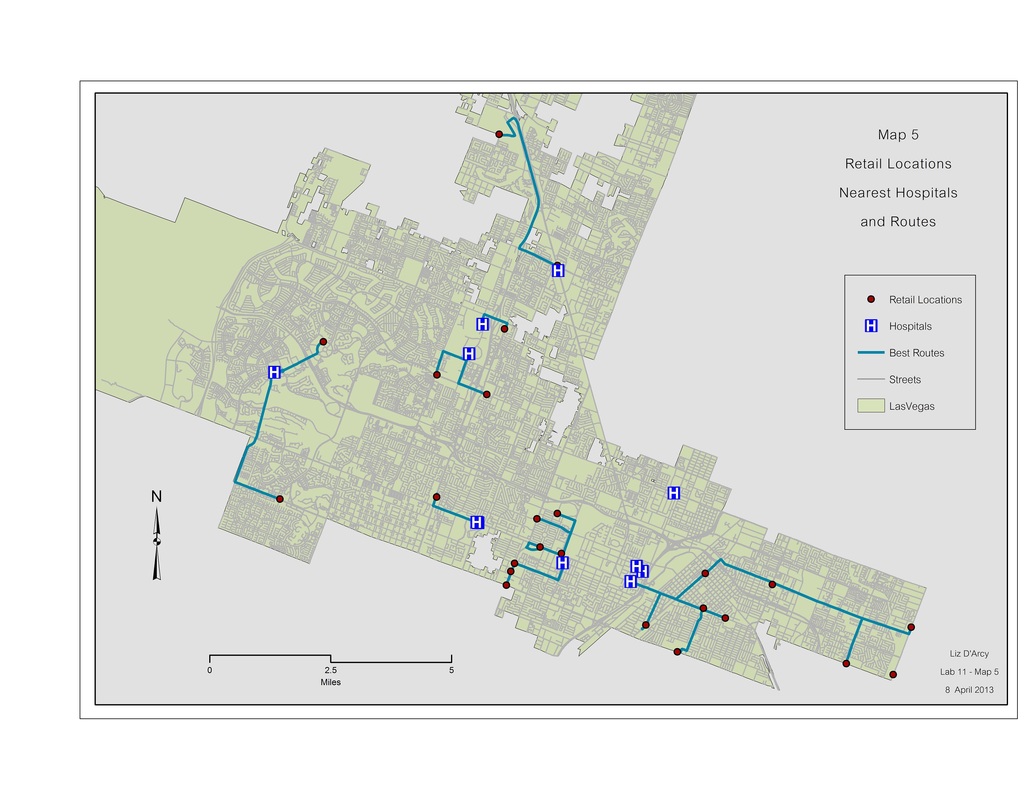
More Network Analysis
Shortest path, impedance problems, service area and closest facility.
|
|
|
|
|
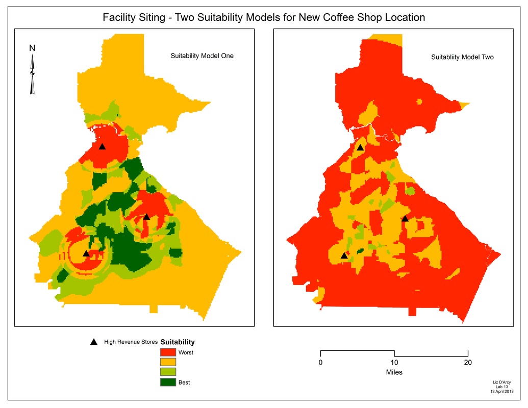
Facility Siting